February 15th, 2026
|
Share with
Your phone is dead. Your compass is broken or lost. The GPS is useless. Now what?
For thousands of years, humans navigated without technology using nature’s built-in directional clues. These methods still work today – and knowing them could mean the difference between walking toward help or deeper into wilderness.
Basic Direction Finding Principles
Cardinal directions:
- North: Toward the North Pole
- South: Toward the equator (for Northern Hemisphere)
- East: Where sun rises
- West: Where sun sets
Why this matters: Knowing direction helps you:
- Travel in straight line (not circles)
- Find landmarks
- Communicate location if rescued
Method 1: The Sun (Daytime Navigation)
Sun’s basic pattern (Northern Hemisphere):
- Rises in the East
- Peaks in the South at noon
- Sets in the West
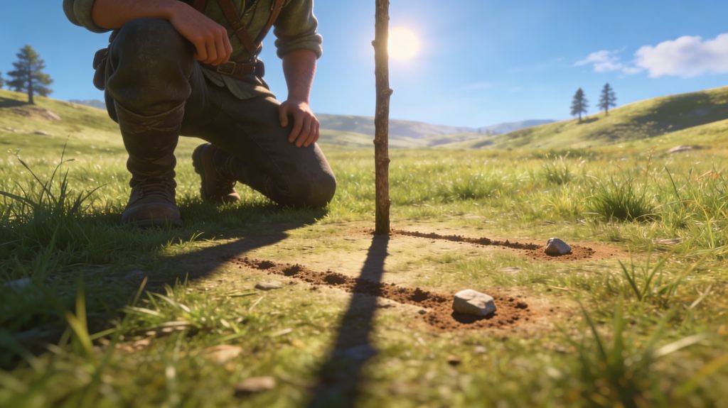
Shadow Stick Method (Most Reliable)
What you need: Straight stick, 2 small rocks, 15-60 minutes
How to do it:
- Plant stick vertically in flat, sunny ground
- Mark shadow tip with rock #1
- Wait 15-60 minutes
- Mark new shadow tip with rock #2
- Draw line between rocks – this runs East-West
- First mark = West, Second mark = East
- Draw perpendicular line = North-South
Why it works: Shadows move opposite the sun. Sun travels east→west, so shadow moves west→east.
Pro tip: The longer you wait between marks, the more accurate your line.
Watch Method
What you need: Analog watch with hour hand, sun
In Northern Hemisphere:
- Point hour hand at the sun
- Bisect (find middle) angle between hour hand and 12 o’clock
- That line points South
In Southern Hemisphere:
- Point 12 at the sun
- Bisect angle between 12 and hour hand
- That line points North
Digital watch? Draw clock face on paper with current time.
Method 2: The Stars (Night Navigation)
North Star (Polaris) – Northern Hemisphere
How to find it:
- Locate Big Dipper constellation (looks like pot with handle)
- Find the two stars forming outer edge of the “pot”
- Draw imaginary line through these stars
- Extend line about 5x the distance between them
- First bright star you hit = Polaris (North Star)
Polaris = True North (nearly exact)
Why it works: Polaris sits almost directly over North Pole and doesn’t appear to move as Earth rotates.
Southern Cross – Southern Hemisphere
How to find South:
- Locate Southern Cross (4 bright stars forming cross/kite)
- Measure long axis of the cross
- Extend line about 4.5× the length
- Drop straight down to horizon
- That point = South
Method 3: Natural Indicators (Use with Caution)
These are HINTS, not guarantees. Use multiple methods together.
Tree and Moss Patterns
Moss myth: “Moss grows on north side of trees”
Reality: Moss grows where it’s damp and shaded – could be any direction
Better tree method:
- Trees often have more branches on south side (Northern Hemisphere) = more sun exposure
- Growth rings are often thicker on south side
- Check multiple trees, look for patterns
Ant Hills
In Northern Hemisphere: Ants often build on south side of trees/rocks where it’s warmer
Reliability: Medium – use with other methods
Snow Patterns
Northern Hemisphere:
- Snow melts faster on south-facing slopes (more sun)
- North-facing slopes hold snow longer
Mountain navigation: Knowing which way is south helps identify slopes
Method 4: Natural Terrain Features
Water Flow
Rivers and streams flow downhill – obvious, but useful:
- Following water downstream usually leads to civilization
- People settle near water sources
- Creates natural navigation path
Caution: Can lead deeper into wilderness if heading to ocean
Prevailing Winds
Research your area’s prevailing wind direction before trip
- Trees may lean away from constant winds
- Sand dunes form based on wind direction
- Useful in areas with consistent wind patterns
Method 5: The Moon
Moon’s light: Reflects sunlight
- East side of moon is lit when moon is west of sun (evening)
- West side of moon is lit when moon is east of sun (morning)
Crude navigation:
- Moon rises in east, sets in west (like sun)
- Less precise than sun/stars but works
Method 6: Using Landmarks (Micro-Navigation)
Create mental map:
- Before hiking, note large landmarks (mountains, water bodies)
- Check map for general direction of these from your position
- Keep landmarks in view to maintain bearing
Triangulation:
- Identify 2-3 known landmarks
- Estimate your position based on their relative positions
- Adjust course accordingly
Method 7: The Straight-Line Walk
Problem: Humans walk in circles when lost (proven fact)
Solution – maintaining straight line:
- Sight a landmark in your direction of travel (tree, rock, hilltop)
- Walk directly to it
- Pick new landmark from that position in same direction
- Repeat
Why it matters: Walking in circles wastes energy and time. Straight lines get you somewhere.
Method 8: Reading Cloud Patterns
Puffy cumulus clouds tend to form over land during day (heat rises)
Cloud movement shows wind direction at that altitude
Limited use – mostly useful for large-scale navigation (finding land from sea)
Priority Rules When Lost
STOP = Stop, Think, Observe, Plan
Rule #1: Don’t panic
- Panic kills. Sit down. Breathe.
Rule #2: Stay put if:
- People know where you are
- You’re injured
- Weather is bad
- You have shelter
Rule #3: Travel if:
- No one knows you’re missing
- You know which way leads to help
- You have energy and daylight
- Weather permits
Rule #4: Signal for help
- Three of anything = distress (3 fires, 3 whistle blasts, 3 rock piles)
- Stay visible from air
Accuracy Reality Check
Most accurate:
- Shadow stick method (sun)
- Polaris (North Star)
- Southern Cross
Moderately accurate:
- Watch method
- Moon direction
Unreliable alone:
- Moss patterns
- Tree shapes
- Ant hills
Always cross-reference multiple methods when possible.
Practice Before You Need It
Weekend exercises:
- Find Polaris without using phone compass app
- Use shadow stick method in your backyard
- Practice landmark sighting while hiking
- Learn regional terrain patterns
The best navigation skill is the one you’ve practiced.
Modern Backup Plan
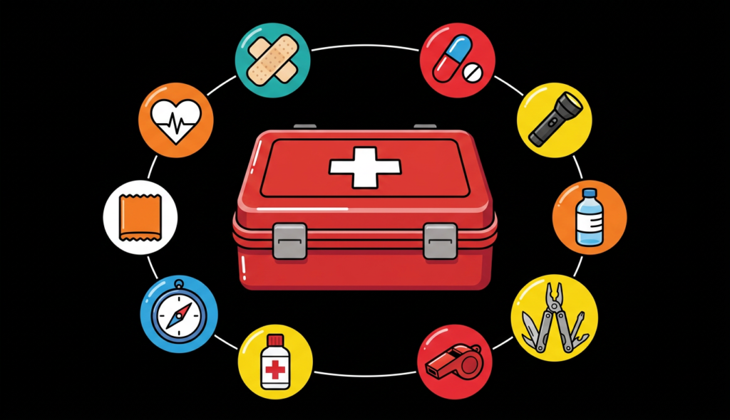
Always carry:
- Compass (backup to GPS)
- Paper map (waterproof)
- Whistle (signaling)
- Mirror (signaling)
Technology fails. Knowledge doesn’t.
Conclusion
Navigation without instruments is part skill, part awareness. Learn to read nature’s signs, practice the reliable methods, and always tell someone your route before heading into wilderness.
Getting lost is a choice. Staying lost is also a choice. Choose knowledge.
If this article opened your eyes, take the next step. Get the 7 Days Emergency Plan and turn basic rescue skills into a calm, organized response to any crisis.